
California Car & Van Rental | Airport Van Rental
Why rent a car in California
Welcome to California, the ultimate road trip state! From the sun-kissed beaches of San Diego to the towering redwoods of Northern California, having a rental car is the key to unlocking every corner of the Golden State. This page is your all-in-one guide to renting a car in California. We’ve blended hard-to-beat rental deals with local expertise to ensure you not only save money but also have the knowledge to drive California’s roads like a pro. Whether you’re flying into LAX for a family vacation, planning a Pacific Coast Highway drive, or need wheels for a business trip in Silicon Valley, we’ll help you find the perfect car quickly, easily, and cheaply.
Search & Book
Ready to hit the road? Enter your California pick-up location and dates above to see instant quotes. We work with every major car rental brand in California (and many local ones), bringing you a huge selection. From economy cars for LA traffic to convertibles for a coastal cruise, you’ll find it here. Our booking system is user-friendly, filter by car type, compare prices, and reserve in under 2 minutes. With free cancellation on most rentals, you can lock in a great rate now and adjust later if needed.
Why Rent a Car in California?
California is big and diverse, larger than many countries, and its attractions are spread out. Renting a car lets you:
- See More SoCal & NorCal: Public transit can get you around cities like San Francisco or LA, but what about Disneyland in Anaheim, wine tasting in Napa, or Yosemite’s trails? A car is often the only practical way to reach California’s national parks, beaches, and small towns on your own schedule.
- Experience Iconic Drives: Drive over the Golden Gate Bridge, wind through the Big Sur coastline, or cross the Mojave Desert to Las Vegas. These classic drives aren’t accessible by tour bus the same way. Having your own car means you can stop at every scenic overlook or quirky roadside diner.
- Travel on Your Timeline: No train or tour schedules, you’re on California time now. Want to detour to a hidden beach or extend your stay in Lake Tahoe by a day? With a rental car, it’s your call.
- Beat the City Sprawl: California cities are famously sprawling. In Los Angeles, for example, having a car can turn a 2-hour bus ride into a 30-minute drive. If you plan to explore beyond a downtown core, a car rental is almost a must to save time and hassle.
Our California Car Rental Advantages
- Huge Vehicle Selection in CA: Whether you need a compact car for San Francisco’s narrow streets, a convertible to soak up the Malibu sun, a minivan for a Disneyland trip, or an SUV for a Tahoe ski getaway, we’ve got them all. Choose from thousands of vehicles across California rental locations.
- Top Deals Guaranteed: We negotiate with our suppliers in California, including major brands and regional companies, to get you the lowest prices. Our meta-search style booking shows you all the best deals in one place. We highlight specials like “Rent for 3+ days and save 15%” or weekend discounts so you never miss a bargain.
- No Pre-Payment Required: Most of our California rentals let you reserve now, pay later at the counter. No upfront charge means no commitment, and no cancellation fees if your plans change (just cancel within the allowed period).
- Free Cancellation & Transparency: Enjoy free cancellation on most bookings up to 48 hours before pick-up. And we HATE hidden fees as much as you do, you’ll see the total price including taxes/fees before you finalize. California has some unique fees (like tourism or stadium taxes in certain cities), but we itemize everything clearly.
- Unlimited Miles in CA: Drive up and down Highway 1 or across the state without watching the odometer. Unlimited mileage is included on virtually all California rentals, no extra fees for putting 500 miles on your ride as you explore. Going from SF to LA and back? No problem, it’s unlimited.
- Local Expertise: This isn’t just a generic site, we have local knowledge. Our site and support team can offer tips on California driving (we’ve included many below!). Plus, we often partner with local attractions, e.g., sometimes we have discount codes for theme park parking or maps for scenic drives ready for our renters.
- Customer Support & Roadside Assistance: Renting through us connects you with 24/7 customer support. Locked out or car trouble at 2 AM on the Vegas run? Our partners’ roadside assistance will get you back on track. Need to extend your rental or change drop-off location? Call us anytime, we’re flexible and here to help.
Today’s Top California Car Rental Deals
(Updated daily: these are a few sample deals available in California. Prices change frequently, but we’re committed to showing you the best offers of the moment.)
- Economy Car from $18/day.Example: Toyota Corolla or similar. Why so cheap? Lots of competition at LAX and SFO means low rates on economy cars.
- Convertible from $45/day.Example: Ford Mustang Convertible or similar. Perfect for cruising Los Angeles or the Pacific Coast Highway with the top down.
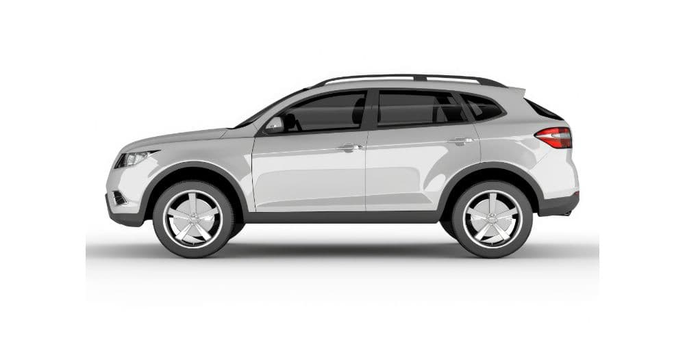
- Midsize SUV from $30/day.Example: Nissan Rogue or similar. A great choice for families, ample cargo space for that trip to Yosemite or Disneyland.
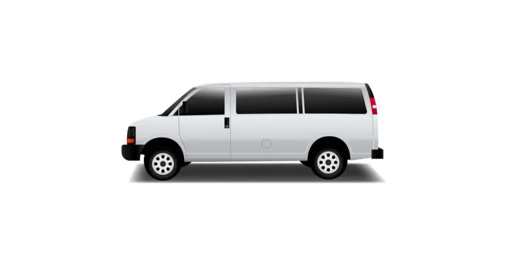
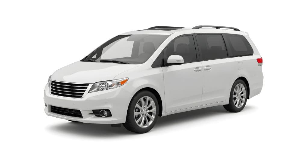
- Minivan from $49/day.Example: Dodge Grand Caravan or similar, seats 7-8. Ideal for group trips, whether it’s a San Diego beach day or a road trip to Vegas. (Note: “From” rates are based on rentals in major hubs like Los Angeles (LAX) and San Francisco. Prices may be higher in smaller markets or during peak travel weeks. Always search for your exact dates and location to get current pricing.)
Driving in California: What to Know
Driving in California can be an adventure in itself, you’ll go from urban freeways to mountain roads to coastal highways. Here are key tips and unique California rules to keep you safe and stress-free:
- Traffic & Rush Hours: California’s big cities are infamous for traffic. In Los Angeles and the Bay Area, rush hour typically runs 7–10 AM and 4–7 PM on weekdays. Freeways like LA’s I-405 or the Bay Area’s I-80 can become parking lots. If possible, plan your long drives during off-peak times or use navigation apps to find optimal routes. Many cities have carpool lanes (HOV lanes) on freeways, marked by a diamond symbol, which you can use if you have 2 or more people in the car (some Bay Area HOV lanes require 3+). These can save a lot of time. But note: driving solo in a carpool lane during restricted hours will get you a hefty fine (tickets can exceed $400 in CA for HOV violation!). So don’t be tempted unless you qualify or have a valid express lane pass.
- Parking in Cities: In downtown areas like San Francisco, parking is at a premium. Read signs carefully before parking curbside, look for street cleaning times, permit requirements (some areas are residential permit only), or time limits. San Francisco’s hills often have one rule unique to CA: curb your wheels when parking on a slope (turn wheels into the curb when facing downhill, or outwards when uphill). It’s required by law in SF and other hilly cities to prevent roll-aways, and you can get a ticket if you don’t. Many urban areas have parking garages, they’re usually safer and easier than street parking, though can be $20-30/day in SF or LA. At beaches, watch for signs about closing times (some beach parking lots close at sunset).
- Speed Limits: California highways generally have a maximum speed limit of 65 mph (urban areas) to 70 mph (rural stretches). Two-lane undivided highways often are 55 mph. In cities, the default speed is 25 mph in residential areas and school zones (when children are present, 25 mph or even 15 mph). Speed cameras are not widely used in CA (unlike some states), but speeding is still heavily enforced by highway patrol, sometimes even by aircraft detection. Also note: exceeding 100 mph is considered reckless driving and can lead to license suspension. Keep an eye out for speed limit changes, for example, on parts of I-5 in central CA it’s 70, but drops to 55 in Los Angeles.
- Hands-Free Driving Law: California has a strict hands-free phone law. It is illegal to hold a phone while driving, no texting, no hand-held calls. Use a Bluetooth or built-in car system for calls, and if you need to text or navigate, use voice commands or have a passenger handle it. Police can and do pull people over for phone use. Fines start around $20 but can climb with fees. Basically, set up your GPS before you drive, and if you must use your phone, pull over safely to do so.
- Unique Road Conditions: California’s geography means varied driving conditions. In winter (typically Nov–March), snow and chain controls can affect mountain routes. If you’re heading to Lake Tahoe, Yosemite, or through the Sierra Nevada, carry tire chains or use a 4WD vehicle with all-season tires when required. Mountain passes can temporarily close for heavy snow, check Caltrans (CA DOT) highway info before going (they have a QuickMap app and 800 number). In summer and fall, wildfire season may cause smoky conditions or even road closures in some areas, keep an ear on local news if driving in forest areas. Desert driving: If you go through Death Valley or Mojave in summer, be prepared for extreme heat, have plenty of water and ensure your car is in good shape (use A/C wisely to avoid overheating on long climbs).
- Tolls in California: California doesn’t have many toll roads compared to the East Coast, but a few exist. Examples: the Orange County toll roads (133, 241, etc.), the 91 Express Lanes in OC/LA, some Bay Area bridges (Golden Gate Bridge, Bay Bridge, etc.), and express lanes around SF and LA. Most are cashless. The Golden Gate Bridge, for instance, has no toll booths, crossing southbound into San Francisco triggers a toll by license plate. Your rental car company will likely charge that to you later with a small fee, unless you’ve arranged a toll pass. If you plan to use a lot of toll lanes (say you commute daily across the Bay Bridge), consider asking for a toll transponder or program from your rental company. Otherwise, you can also pay some tolls online: e.g., Golden Gate allows a one-time payment online by the next day to avoid rental fees.
- Gasoline (Fuel): California gas is pricy, often the highest in the U.S. California requires a special cleaner fuel blend and has higher taxes, so don’t be surprised if prices are $1+ more per gallon than in neighboring states. As of May 2025, CA average gas price is about $4.85/gal (versus $3.26 national average). In big cities and remote areas like Big Sur, it can even top $5-6. Plan fuel stops accordingly; for example, gas up before driving into remote areas or national parks where prices jump. Self-serve is the norm; note that in Oregon (next door) you can’t pump your own gas in many counties, but in CA you do it yourself.
- Smog Checks & Environmental Zones: If you’re driving into central parts of some cities, be mindful of any local environmental rules. California has strict emissions laws, but as a visitor in a rental car, you won’t encounter “low emission zones” like in Europe. However, certain highways have advisories (e.g., spare the air days). Just ensure you don’t tamper with the vehicle’s emissions or engine, but why would you, it’s a rental!
- Wildlife and Nature: In rural California, especially at dawn/dusk, watch for wildlife on roads. Hitting a deer can wreck your trip (and the car). Up in the mountains or woods, you might see deer, coyotes, or even bears crossing. In desert areas, wild burros (donkeys) sometimes graze near highways. Use high beams on dark country roads when no one’s coming the opposite way, it helps spot animal eyes reflecting. Along the coast, you’re more likely to deal with fog, slow down, use low beams (not high beams) in fog, and give yourself extra time.
- Law Enforcement: The California Highway Patrol (CHP) monitors highways, you’ll often see their black-and-white cars hiding around bends. If you’re pulled over, safely signal and pull to the right shoulder as soon as feasible. Stay in the car, hands visible. The officer will approach and instruct you. They’re usually polite if you are. Traffic fines in CA can be steep (running a red light is ~$500 once fees are added!). Also, it’s state law to “Move Over” if there’s an emergency vehicle or tow truck on the shoulder, either change lanes away or slow down significantly. This is for everyone’s safety.
Overall, California offers excellent driving experiences, just be prepared for variety. One day you might be in bumper-to-bumper LA traffic, the next day cruising an empty mountain byway. If you follow the rules above and stay alert, you’ll do great and enjoy some of the best views and destinations America has to offer.
Road Trip Ideas from California
California is synonymous with road trips. Here are three detailed itineraries showcasing different sides of the state, feel free to use these as inspiration for your own journey:
Pacific Coast Highway (Los Angeles to San Francisco)
Distance: ~450 miles via the scenic route (plan 2–3 days one-way).
Route: Start in Los Angeles. Take US-101 and then switch to Highway 1 (Pacific Coast Highway) at Santa Monica, heading north along the coast all the way to San Francisco.
Highlights: This is California’s most famous drive for good reason. Begin by cruising through Malibu’s beachside vistas. Consider a stop in Santa Barbara for a stroll by the mission and a taste of local wine. As you continue north, the landscape shifts, by San Luis Obispo, get ready for the Big Sur stretch, often called one of the most beautiful coastal roads in the world. Here, the Santa Lucia Mountains plunge into the Pacific Ocean, and the highway clings to cliffs. Must-sees: Morro Rock towering over Morro Bay, the elephant seal colony at Piedras Blancas, the iconic Bixby Creek Bridge, and Julia Pfeiffer Burns State Park where McWay Falls drops onto a beach. Take your time through Big Sur, pull off at turnouts to soak in the views (and let locals pass). Past Big Sur, enjoy artichoke fields in Castroville and the Monterey Bay area, visit the Monterey Bay Aquarium or charming Carmel-by-the-Sea. Finally, approach San Francisco via the scenic 17-Mile Drive in Pebble Beach or continue on Highway 1 through Half Moon Bay. Cross the Golden Gate Bridge into SF if you can (from the south, you can loop around to enter over the bridge for that classic view).
Tips: Plan overnight stops. Many do one night in Cambria or San Luis Obispo, and another in Monterey or nearby. Lodging in Big Sur fills up, so reserve ahead (or stay in Monterey/Carmel and do Big Sur as a day trip loop). Gas up in bigger towns (Gas is scarce and pricey in Big Sur, e.g., only a couple of stations, with prices well above average). Cell service is spotty on the remote sections. Driving can be slow behind RVs, and that’s okay! Embrace the journey. If you’re prone to motion sickness, take precautions, the curves are continuous. Lastly, check road conditions; mudslides occasionally close parts of Highway 1 in winter, in which case you’d detour to US-101. But when open, this road trip is pure magic for anyone who loves ocean views.
Desert Escape (Los Angeles to Las Vegas via Mojave)
Distance: ~270 miles (4–5 hours nonstop; easily 6–7+ hours with fun stops).
Route: From Los Angeles, take I-15 North through the Mojave Desert to Las Vegas, Nevada.
Highlights: This classic drive transports you from California’s urban sprawl to open desert and ends in the neon oasis of Vegas. Along the way, there are some quirky and worthwhile stops. About 2 hours out of LA, stretch your legs in Barstow or nearby Calico Ghost Town, an Old West mining town turned tourist attraction, pan for gold or tour the historic mine. Barstow is also home to the Route 66 Mother Road Museum if you’re a history buff. Further on I-15, you can detour a few miles to Peggy Sue’s 50’s Diner in Yermo, a kitschy retro diner that’s a favorite pit stop for shakes and photo ops. As you continue, you’ll see the immense emptiness of the Mojave; don’t be surprised if you spot billboards far out advertising Vegas shows, it builds the anticipation! If you have time, a detour to Mojave National Preserve is beautiful (Kelbaker Road exit), you can see cinder cone volcanoes and the Kelso Dunes (though that’s an adventure requiring extra time). Approaching Nevada, you’ll cross stateliness and soon see the casinos of Primm on the border (maybe try the roller coaster at Buffalo Bills if it’s running!). Finally, roll into Las Vegas, preferably by evening when the lights of the Strip beckon, an incredible contrast to the silent desert you came through.
Tips: One-way rentals: Many folks pick up in LA and drop in Vegas, we often have deals with no drop fee on this route, making it convenient. If you’re returning to LA, consider a different route back (like via Death Valley or Joshua Tree) to mix it up. Fuel up in Barstow or Baker: Gas can be extremely expensive at the lonely Desert oasis stations (like the one at Baker by the world’s tallest thermometer). Watch your speed. The freeway is long and straight, easy to speed unintentionally. The California Highway Patrol monitors I-15 regularly, including by airplane (you’ll see white lines on the road marking VASCAR timing zones). Also, winds can be strong through certain passes, keep both hands on the wheel if it’s gusty. Summertime travelers: the Mojave can be 110°F (43°C) or more. Ensure your car’s engine is in good shape (if the A/C cuts out or car feels hot, turn off A/C for a bit and/or pull over at a rest stop). Always have water for each passenger. Lastly, remember Nevada has a different time zone part of the year (Nevada and California are both Pacific Time; Arizona nearby is Mountain Standard year-round), not a big issue to Vegas though. Enjoy the journey and viva Las Vegas at the end!
Sierra Nevada Journey (San Francisco to Yosemite National Park)
Distance: ~200 miles from San Francisco to Yosemite Valley (approximately 4–5 hours drive).
Route: From San Francisco, take I-580/I-205 East to Manteca, then CA-120 East all the way into Yosemite National Park (via the Big Oak Flat Entrance).
Highlights: This road trip takes you from the Bay City to the heart of the Sierra Nevada mountains. Start by crossing the Bay Bridge or San Mateo Bridge out of SF, heading into California’s Central Valley. Consider a quick stop in Livermore or Lathrop for snacks, once you head up CA-120, options get sparser. As you drive through the Valley, you’ll see miles of orchards and farms (almonds, apricots, etc.). Near Oakdale, known as the “Cowboy Capital” of California, you could visit a local creamery or grab a classic American diner meal. Heading into the Sierra foothills, the road winds by gold rush towns. Jamestown and Sonora are charming historic towns just off CA-120/108, if you have time, they’re worth a detour for antique shops and even a ride on a historic steam train at Railtown 1897 State Park in Jamestown. When you turn onto CA-120 toward Groveland, you’ll drive through oak woodlands that transition to pine forest. Groveland is a last chance to fuel up and grab any supplies before the park (also home to the Iron Door Saloon, one of California’s oldest saloons). Entering Yosemite, prepare for jaw-dropping scenery. As you descend into Yosemite Valley, you’ll emerge from a tunnel to the famous Tunnel View, offering a panoramic vista of El Capitan, Half Dome, and Bridalveil Fall all at once (a perfect photo op). Drive into the valley floor to experience Yosemite’s splendor up close: towering granite walls on either side, Yosemite Falls (if in spring/early summer), and lush meadows. Park and explore by foot or the free shuttle, the valley is only 7 miles long.
Tips: Reservations: Note that in peak season (especially summer), Yosemite may require advance reservations to enter the park during certain hours/days. Check the National Park Service Yosemite website before your trip. If needed, arrive during off-peak times (early morning or late evening) to ensure entry, or book a reservation/pass. Driving in Yosemite: Speed limits are low (25-35 mph) and strictly enforced by park rangers. Watch for wildlife, deer, black bears, and even bobcats can cross roads, especially at dawn/dusk. Do not leave any food or scented items in the car when parked in Yosemite; use food storage lockers or carry food with you, this is to prevent curious bears from breaking into vehicles. Fuel: There’s a gas station at Crane Flat (on CA-120 near the park entry) and one in El Portal (Hwy 140 side), but prices are higher, so it’s wise to top off in Groveland. Chains in winter: If traveling in late fall, winter, or early spring, carry tire chains; Yosemite weather can change quickly and chain requirements go into effect during snow/ice (even if SF was sunny when you left!). Lastly, for the full experience, consider staying a night or two at Yosemite (lodges or camps) because a day-trip will be quite rushed, but if a day is all you have, it’s still absolutely worth it. The drive itself, passing from city to plains to mountains, really highlights California’s incredible geographic diversity in just a few hours.
(Want more road trip ideas? Check out our dedicated California Road Trips guide or ask us for a custom itinerary! We’ve got suggestions from Wine Country escapes to San Diego-to-Grand Canyon adventures.)
Popular California destinations
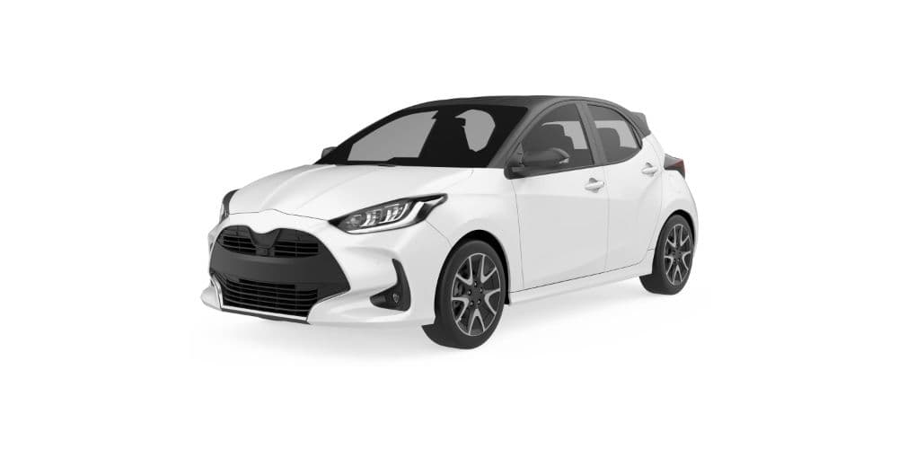
Our Most Popular Vehicles
Frequently Asked Questions
California’s public transportation between cities is limited, for example, there’s no state-wide train network that efficiently connects all the tourist spots. Within cities, while places like San Francisco have decent transit, many SoCal areas (Los Angeles, San Diego) are very spread out. Rideshares (Uber/Lyft) can handle point-to-point needs, but costs add up quickly if you’re sightseeing across distances. Renting a car often saves money and time when you have multiple places to visit. It gives you the freedom to go where buses don’t (think Big Sur vistas or a hidden beach cove). Plus, if you’re traveling as a family or group, having a car is usually far more convenient for carrying luggage, beach gear, or souvenirs, and more comfortable than crowded public transport. In short, a rental car lets you experience California on your own schedule, which often means seeing more in the same amount of time. (One exception: if your trip is just staying in dense areas of San Francisco or downtown LA with minimal roaming, you might skip a car for those days to avoid parking hassles. You can always rent only for the road trip portion.)
If you’re visiting from abroad, driving in California is generally straightforward and often easier than in many other countries (wide roads, mostly automatic cars, English road signs). However, a few things to adjust to: 1) Distances are in miles, speeds in miles per hour, and fuel in gallons. If you’re used to kilometers, remember that 1 mile ≈ 1.6 km (so 60 mph ~ 100 km/h). 2) Traffic flows on the right-hand side. If you’re from a left-side country (UK, Australia, etc.), pay extra attention at intersections until you’re comfortable. The car will likely have the driver’s seat on the left side; it feels odd at first, but you’ll adapt quickly. 3) At multi-way stop signs, the rule is first come, first go, if you and another car arrive simultaneously, the car on the right has right-of-way. 4) Right on red: you can turn right at a red traffic light after coming to a complete stop (unless a sign says “No Right on Red”). This is different from many countries and can be convenient, but always yield to pedestrians and cross traffic. 5) Freeway exits can be on the right or left, though majority are on the right, watch the signs in advance. 6) Units: Speed limits like “65” mean 65 mph (~105 km/h). Gas prices “per gallon”, note a gallon is ~3.79 liters. 7) Driving culture: Californians often cruise a bit above the limit on freeways (5-10 mph over is common flow), but speeds vary; keep to the right if you want to go slower. Use turn signals (indicators) for lane changes, sadly not everyone does, but you should. Overall, if you follow the rules, use GPS for guidance, and take it easy until you get used to the car, you’ll be fine. And our support team is just a call away if you have any confusion on the road.
California is full of scenic drives. A few favorites: Pacific Coast Highway (Highway 1), especially the Big Sur section between Monterey and San Luis Obispo (as we detailed above). Highway 395 along the Eastern Sierra, stunning mountain vistas, with stops like Mono Lake and Mammoth Lakes. Joshua Tree National Park has a loop road through otherworldly desert rock formations and Joshua trees. 17-Mile Drive in Pebble Beach (near Monterey), a short toll road through beautiful coastline and golf courses (costs about $11 for cars, but worth it for Lone Cypress photo op). Sonoma and Napa Valley roads, rolling vineyards, especially pretty in autumn harvest season. Highway 49 (Gold Rush country), winds through historic towns in the Sierra foothills with pastoral scenery. Death Valley’s Badwater Road & Artist’s Drive, surreal desert landscapes below sea level (not in summer though!). Lake Tahoe’s perimeter road (NV Hwy 28 & US 89), jaw-dropping alpine lake views. And we can’t forget Mulholland Drive in Los Angeles for city views, or Angeles Crest Highway above LA for twisty mountain scenery. All these drives are accessible with a standard rental car (no 4x4 needed, except sometimes in winter for mountain routes). If you have a particular region you’re visiting, ask us for a recommendation, California has dozens of scenic byways. Pack your camera, and enjoy the ride!
A few California-specific laws to note: Helmet and headset laws, motorcyclists must wear helmets (as a driver you likely won’t deal with this, but good to know if you rent a scooter or motorcycle). It’s illegal for a driver to wear a headset or earplugs in both ears while driving (you can have one earbud for phone calls, but not two, so don’t drive with noise-cancelling headphones on!). Smoking in Cars, it is illegal to smoke or vape in a car if any minor (under 18) is present, even with windows down. Open container, you cannot have open alcoholic beverage containers accessible in the car, even passengers (except in limos/RVs under certain conditions). Move Over law, as mentioned, if there’s a vehicle with flashing lights on the shoulder (police, tow truck, etc.), move to another lane away from it or slow down significantly. License plates, California requires both front and back plates on cars (your rental will have them), and it’s illegal to cover them (don’t put those souvenir plate covers on). Noise, excessive use of the horn (outside of necessary warning) is technically illegal; using it in anger in quiet zones could get you cited. Tire squealing or street racing, obviously illegal. And one more quirky one: in California, you’re actually not allowed to use the roadway as a “personal bathroom” (yes, people have tried to claim emergency stops for that reason!), basically, don’t stop on freeway shoulders unless it’s a real emergency. Most of these won’t come up, but it’s always good to drive prudently and be respectful of local rules.
Gas (petrol) prices in California are higher than the U.S. average, currently around $4 to $5 per gallon for regular unleaded, depending on the region (cheaper in the Central Valley, pricier along the coast and remote areas). We recommend renting on a full-to-full fuel policy, which most companies use: you get the car with a full tank, and you refill it to full just before returning. This is the most cost-effective approach, because you’ll pay pump prices. If you don’t return it full, the rental company will charge a much higher per-gallon rate (often $7-10/gal). Some companies offer a prepaid fuel option where you pay for a full tank upfront at a competitive rate and can bring it back empty, but unless you’re certain you’ll use nearly the whole tank, it’s usually not worth it (you don’t get credit for unused fuel). So, plan to stop at a gas station within ~5-10 miles of the drop-off location. Keep your receipt in case they ask for proof. One exception: if you have an early morning flight, you might consider prepaying to save time, but otherwise, fueling yourself saves money. Also note: California has many gas station brands; any will do, but some upscale ones (Chevron, 76) might be slightly pricier. It’s okay to use cheaper stations like ARCO, the rental car doesn’t mind, just use the correct octane (87 regular for most cars).